sumac
New member
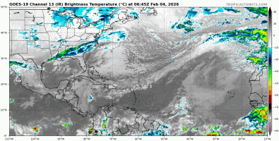
Yet again, another deluge of rainfall to hit Portugal and Spain....
STORM LEONARDO - MAINLAND - RAIN, SNOW, WIND AND ROUGH SEAS
INITIALLY approach of a front to BAIXO ALENTEJO AND ALGARVE REGIONS, starting in the LATE AFTERNOON OF FEB 3RD
LEONARDO is the name given by IPMA - Azores to a low pressure system, which is expected to be centered at 49°N and 26°W at 12UTC on February 4th, approximately 1100 km north of the Azores archipelago, within a vast low-pressure area where several nuclei will evolve in the coming days.
The fronts associated with Storm LEONARDO will affect the weather in mainland Portugal FROM THE AFTERNOON OF FEB 3RD UNTIL FEB 7TH, with persistent and sometimes heavy precipitation, snowfall, strong winds and rough seas.
Mainland Portugal will feel the effects of the STORM LEONARDO, INITIALLY with the approach of a front to BAIXO ALENTEJO AND ALGARVE REGIONS, starting in the LATE AFTERNOON OF FEB 3RD, bringing persistent and sometimes heavy rainfall and wind gusts that could reach 75 km/h on the coast south of Cabo Mondego (Figueira da Foz) and 95 km/h in the highlands.
This front will gradually extend to the remaining regions of the mainland during Feb 4th, with the period of highest accumulated precipitation and strongest winds expected to be the night of Feb 4th to Feb 5th,
It gradually transitioning to showers, which may include hail and thunderstorms, with snowfall above 1500/1600 m, gradually dropping to 1200/1400 m, and with a temporary weakening of the wind between the afternoon of Feb 5th and the morning of Feb 6th.
The highest accumulated precipitation values are expected in the mountainous regions of the North and Center, potentially reaching 150 to 250 mm (l/m2) in some locations between Feb 3rd and 7th.
The sea will remain rough during this period, with waves from the west expected to reach a significant height of up to 6 m on the west coast, potentially reaching a maximum height of 11 m, temporarily decreasing between the afternoon of Feb 4th and the morning of Feb 5th.
Due to this situation, ORANGE and YELLOW level weather warnings have been issued, specifically for precipitation, snow, wind gusts, and rough seas.
Monitoring of these warnings is advised. This statement will be updated on February 3, 2026, at 19UTC.
 www.ipma.pt
STORM LEONARDO - MAINLAND - RAIN, SNOW, WIND AND ROUGH SEAS
INITIALLY approach of a front to BAIXO ALENTEJO AND ALGARVE REGIONS, starting in the LATE AFTERNOON OF FEB 3RD
LEONARDO is the name given by IPMA - Azores to a low pressure system, which is expected to be centered at 49°N and 26°W at 12UTC on February 4th, approximately 1100 km north of the Azores archipelago, within a vast low-pressure area where several nuclei will evolve in the coming days.
The fronts associated with Storm LEONARDO will affect the weather in mainland Portugal FROM THE AFTERNOON OF FEB 3RD UNTIL FEB 7TH, with persistent and sometimes heavy precipitation, snowfall, strong winds and rough seas.
Mainland Portugal will feel the effects of the STORM LEONARDO, INITIALLY with the approach of a front to BAIXO ALENTEJO AND ALGARVE REGIONS, starting in the LATE AFTERNOON OF FEB 3RD, bringing persistent and sometimes heavy rainfall and wind gusts that could reach 75 km/h on the coast south of Cabo Mondego (Figueira da Foz) and 95 km/h in the highlands.
This front will gradually extend to the remaining regions of the mainland during Feb 4th, with the period of highest accumulated precipitation and strongest winds expected to be the night of Feb 4th to Feb 5th,
It gradually transitioning to showers, which may include hail and thunderstorms, with snowfall above 1500/1600 m, gradually dropping to 1200/1400 m, and with a temporary weakening of the wind between the afternoon of Feb 5th and the morning of Feb 6th.
The highest accumulated precipitation values are expected in the mountainous regions of the North and Center, potentially reaching 150 to 250 mm (l/m2) in some locations between Feb 3rd and 7th.
The sea will remain rough during this period, with waves from the west expected to reach a significant height of up to 6 m on the west coast, potentially reaching a maximum height of 11 m, temporarily decreasing between the afternoon of Feb 4th and the morning of Feb 5th.
Due to this situation, ORANGE and YELLOW level weather warnings have been issued, specifically for precipitation, snow, wind gusts, and rough seas.
Monitoring of these warnings is advised. This statement will be updated on February 3, 2026, at 19UTC.