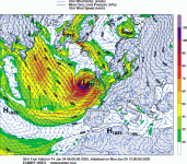
A few of us have been discussing this potential storm event for a few days now, watching the model runs come in. Obviously back on Sunday there was a lot of uncertainty and there still is, however it looks to be firming up for a severe gale event for most of the western UK and especially the northwest, including Ireland, Scotland and western England.
UKMO synoptic charts show the low pressure system bottoming out at 938mb as the system tracks slight back out offshore. 938mb is pretty incredible and very concerning.
We're getting to the point where we can start to watch current analysis and satellite loops of the development.
It's exciting for us weather nerds, but of course we never wish any damage or loss of life. This does look a dangerous storm.
Storm Eowyn............ discuss away !!!
I've attached the 96hr ukmo synoptic chart...
View attachment 1
UKMO synoptic charts show the low pressure system bottoming out at 938mb as the system tracks slight back out offshore. 938mb is pretty incredible and very concerning.
We're getting to the point where we can start to watch current analysis and satellite loops of the development.
It's exciting for us weather nerds, but of course we never wish any damage or loss of life. This does look a dangerous storm.
Storm Eowyn............ discuss away !!!
I've attached the 96hr ukmo synoptic chart...
View attachment 1